Less visible than the headlines from 2011 but no less significant: along Japan’s northeast coast a slow, local-led recovery has produced a 1,000‑kilometre walking route that links ruined towns, dramatic shorelines and communities still rebuilding a decade later. The Michinoku Coastal Trail offers a way to see how tourism, landscape and memory intersect — and why this corridor matters now for residents and visitors alike.
From devastation to a long-distance footpath
After the earthquake and tsunami of 2011, much of the Tōhoku coastline was swept away. In June 2019, a continuous route stretching from Hachinohe in Aomori Prefecture to Soma in Fukushima — known as the Michinoku Coastal Trail or MCT — opened to walkers. The trail threads together mountain paths, farm tracks and seaside promenades, deliberately routing hikers through towns that lost infrastructure and livelihoods in the disaster.
The MCT was conceived not as a memorial in stone but as a practical strategy: a way to bring steady visitors to communities, supporting local businesses and giving younger residents reasons to stay.
Cliffs, volcanic rock and the ‘Alps of the Sea’
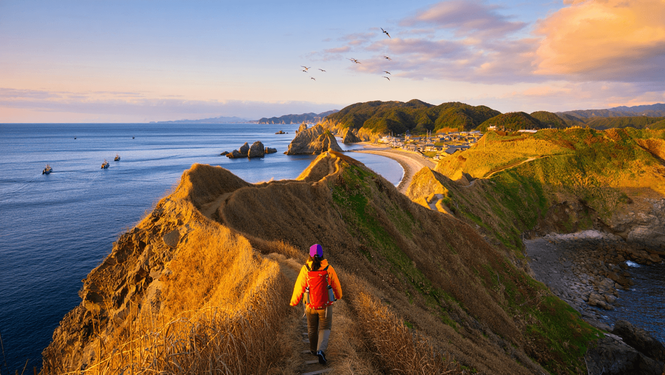
I began my walk in Miyako, in northern Iwate. Within minutes of setting off beneath stands of red pine the coast revealed sheer cliffs rising hundreds of metres — a landscape that felt raw and almost alien. The hiking here moves quickly between exposed headlands and sheltered inlets, where turquoise water crashes into sea caves.
One of the best-known sights near Miyako is the sculpted volcanic outcrops of Jōdogahama — jagged, wind-shaped rocks that extend off the bay and, remarkably, survived the 2011 waves. Their survival has turned them into a local symbol of endurance.
Ofunato’s museum of memory
Further south, the Goishi coast offers bright sea views and narrow coastal tracks. In Ofunato I met locals who are rebuilding stories as well as landscapes. Waichiryo Katayama — known simply as Waichi — built a small, hands‑on museum in Okirai from materials gathered after the tsunami. It’s more than a collection of artifacts; it’s a community space with an outdoor play area and places to gather.
A single exhibit captures how small changes mattered: a staircase that links a school’s second floor to high ground, recommended to city councillors just months before the disaster, saved dozens of lives. The structure now sits in the museum as a reminder of both risk and preparedness.
Sendai: when trail meets city
The trail passes through Sendai, Tōhoku’s largest city and the nearest major centre to the earthquake’s epicentre. Here the MCT changes pace. Neon-lit shopping streets and large malls sit a short distance from beaches and wetlands. The contrast underlines a central point of the project: this is not only a wilderness walk, it is a route that connects urban life with remote coastal communities.
One of the people instrumental in making the trail navigable was Yusuke Sakuraba from the Ministry of the Environment, who personally marked hundreds of kilometres of the route. His involvement — walking long sections with his child — exemplifies the grassroots nature of the trail’s creation.
Fukushima’s coastline and a complex legacy
At the southern end of the MCT lies a landscape many international readers associate first with the Fukushima Daiichi nuclear accident. The 2011 tsunami overtopped the plant’s seawall, triggering meltdowns and a long evacuation. Yet along the route toward Soma the coastline reveals mountain-backed bays, small fishing towns and fields — a reminder that Fukushima is more than a single, tragic episode.
In Soma a primary school near the shore became a high ground refuge during the disaster; its story is one of many that visitors encounter on the trail, where rebuilt roads sit beside traces of what was lost and communities continue to adapt.
Even a short stretch of the MCT gives a strong impression of the area’s character: landscapes that are weathered but alive, and people whose responses to trauma have included reconstruction, creative reuse and collective memory work.
Practical notes for hikers
If you’re considering part of the route, these points will help you plan:
- Length and choice: The full trail is roughly 1,000 km and typically takes about 44 days to walk end-to-end; most visitors choose individual sections.
- Best seasons: Spring (March–June) and autumn (September–December). Summer is hot and humid; winter brings snow in places.
- Accommodation: Towns along the way offer guesthouses and small inns; locals sometimes invite campers to use garden space.
- Guides: Not required, but local guides add historical context, navigate rural transport and point out lesser-known sites.
- Access: The trail is reached by regional trains and buses; plan transfers carefully in more rural stretches.
Walking the MCT is more than a nature experience. For many walkers it becomes a way to witness an ongoing recovery: economies seeking sustainable visitors, communities preserving memory and landscapes that continue to shape local life. That blend of environmental beauty and social resilience is what makes the Michinoku Coastal Trail a travel route worth watching — and walking.
Similar Posts
- Pekoe Trail Sri Lanka: what hikers need to know now
- Explore Wales: Discover Epic Scenery While Traveling
- North Coast 500: locals urge responsible travel as tourism soars
- Samaria Gorge hike: updated tips and essential rules for Crete visitors
- California trail reopens after 13-year closure: prime hiking access restored

A globe-trotter and international trade enthusiast, Oliver explores the connection between business travel and trade opportunities.

